

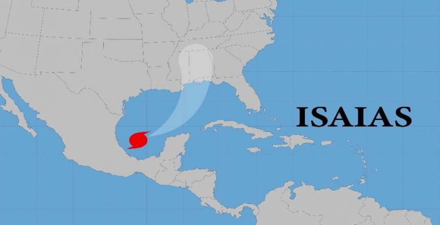
Isaias strengthened Thursday into a Category 1 hurricane as it moved across the Gulf of Mexico toward the U.S. Gulf Coast, where forecasters warned of dangerous storm surge, heavy rain and damaging winds in coastal communities from Louisiana to the Florida Panhandle. Isaias became the first hurricane of the 2026 Atlantic season late Wednesday, ending an unusually long stretch without a hurricane in the basin.
According to reports from the National Hurricane Center, Air Force Reserve Hurricane Hunter aircraft confirmed maximum sustained winds had reached 75 mph while the system advanced east-northeast at roughly 9 mph. Forecasters anticipate additional intensification before the storm makes landfall late Friday or early Saturday along the northern U.S. Gulf Coast.
Hurricane warnings now extend from Ocean Springs, Mississippi, to the border of Bay and Gulf counties in Florida. Meteorologists warn that a life-threatening storm surge reaching 5 to 7 feet above ground level could inundate low-lying shorelines, including Mobile Bay. In response to the escalating danger, local authorities are urging residents to take immediate precautions, with weather officials instructing populations in vulnerable areas to “evacuate if told to do so”.
Government leaders across the region have moved quickly to mobilize disaster response resources as the system accelerates. Florida Governor Ron DeSantis declared a state of emergency covering more than two dozen counties, while Alabama Governor Kay Ivey enacted emergency declarations for 40 counties across her state. Educational institutions are taking precautionary measures as well, with Florida State University transitioning to remote operations and canceling classes to ensure student safety.
Beyond damaging coastal winds and inundation, inland communities face serious severe weather threats as heavy atmospheric moisture pushes across the region. Torrential rainfall is projected to trigger localized flash flooding, and atmospheric conditions will become favorable for spin-off tornadoes beginning Friday night across portions of coastal Alabama, Georgia, and northern Florida. Weather service offices as far north as Pennsylvania are monitoring the system’s eventual track, preparing for widespread soaking rains over the weekend.
Editorial credit: Zinaida Shevchuk / Shutterstock.com